Search any place or drop a GPX. Get a 3D terrain model, ready to print and display.
Upload GPX · Pricing · Docs
The map becomes a model.
Terrain
Pick a place and its terrain lifts out as a smooth, solid model on a flat base, at real elevation. This one is Hong Kong Island, seen from the harbour.
Your route
Your GPX becomes a raised ribbon that follows every switchback. This loop runs 7.9 km from Central up to the Peak and out along Lugard Road.
Water
Victoria Harbour comes in as its own part, ready for blue filament.
Roads and buildings
With City Mode, streets and buildings stand at real height, from open map data.
Real-world color
Color from satellite imagery, reduced to a handful of filaments, so a multi-color printer paints the real landscape for you.
Then it prints
Every feature, every layer. Your printer builds it up from the base, switching filament as each color appears.
Why it exists
We believe the places that matter to us should be more than memories on a screen. TrailMark3D makes the world tangible, turning meaningful places into physical objects you can create, hold, and keep.
Real terrain, your route, ready for your printer.
Real elevation data
Built from global elevation models, so every ridge and valley sits where it does on the ground.
Your route on the land
Drop the GPX from your watch or app and the trail runs across the model, raised or carved.
Any place, no GPX needed
Search a summit, a national park, a city or plain coordinates and build it straight away.
Water and landcover
Lakes, rivers, forest and rock as separate colors, ready for a multi-color printer.
Jigsaw puzzle
Split the model into interlocking pieces, up to 28×28, that slide together. Each piece is its own part in the 3MF.
Cities in 3D (Pro)
Buildings and streets rise out of the terrain, from Hong Kong's hills to San Francisco's grid.
Multi-day trips (Pro)
Up to 7 days as one tile per day, each at full print size, or the whole trip on one tile.
Extension tiles (Pro Plus)
Need more ground? Add up to 59 matching tiles around a model. They print separately and line up edge to edge into one bigger map.
From GPX file to 3D printed map in three steps.
Pick a place or drop a GPX
Search anywhere on Earth, or upload the track from your watch, Strava or Garmin.
Shape it
Choose the size and shape, add water, landcover, contours or city blocks, and turn it around in 3D.
Download and print
Get a print-ready STL or 3MF and slice it for your printer. Hang it, gift it, put it on the shelf.
Frame it to fit.
A square tile doesn't have to hang in a square. Drop your model into the frame builder and it sizes a frame around it. Pick the shape, set the border, add a name, then export and print it with the tile.
- Import your model and the frame sizes itself around it
- Circle, square, rectangle, hexagon or octagon, around any tile
- Raised text on the border, in its own colour with 3MF
- Connector keys to clip frames together, and screw holes to hang them
Open the frame builder · Free with an account. In beta.
Print it as a puzzle.
Any model can come apart. Switch on the puzzle and the terrain is cut into interlocking pieces, peaks and valleys included. Choose how many, generate, and print a jigsaw of a place you know.
- The cut is drawn on the map as you set columns and rows
- A grid on square tiles, rings of cells on circles, hexagons and octagons
- Clearance tuned for FDM, so pieces slide together without fusing
- Every piece is its own object in the 3MF, spread out on the plate
Free with an account up to 6×6. Pro goes to 28×28.
Every day, every leg, in print.
Walked the Tour du Mont Blanc in four days? Raced a triathlon or a duathlon? Drop all the GPX files at once, one per day or one per leg. Each trail gets its own color, on its own tile or all together on one map, ready to print.
- Triathlon, duathlon and stage races, one GPX file per leg
- One tile per day or leg at full size, or all of them on one map
- A trail color for each, picked from Bambu Lab filaments and saved in the 3MF
- Up to 7 GPX files on Pro, up to 60 on Pro Plus
Pro and Pro Plus. A color per trail is Pro Plus.
Every kind of 3D printed map, step by step.
Tutorials with a screenshot of every step, from a GPX file or a place name to a finished print.
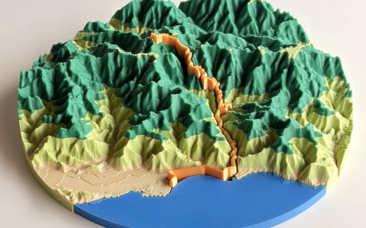
GPX to STL for 3D printing
Turn a Strava, Garmin or Komoot track into a terrain map with your route raised on top.
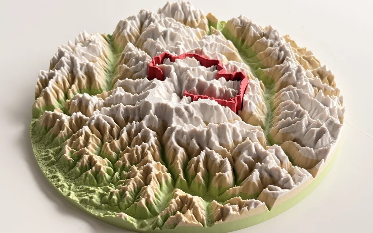
3D terrain map of any place
Search a mountain, a national park or coordinates and get a topographic model, no GPX needed.
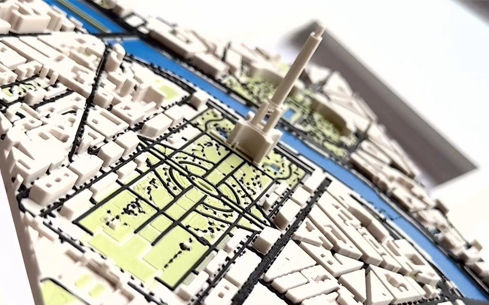
3D printed city maps
Streets and buildings at real height on the terrain, from Paris to your hometown.
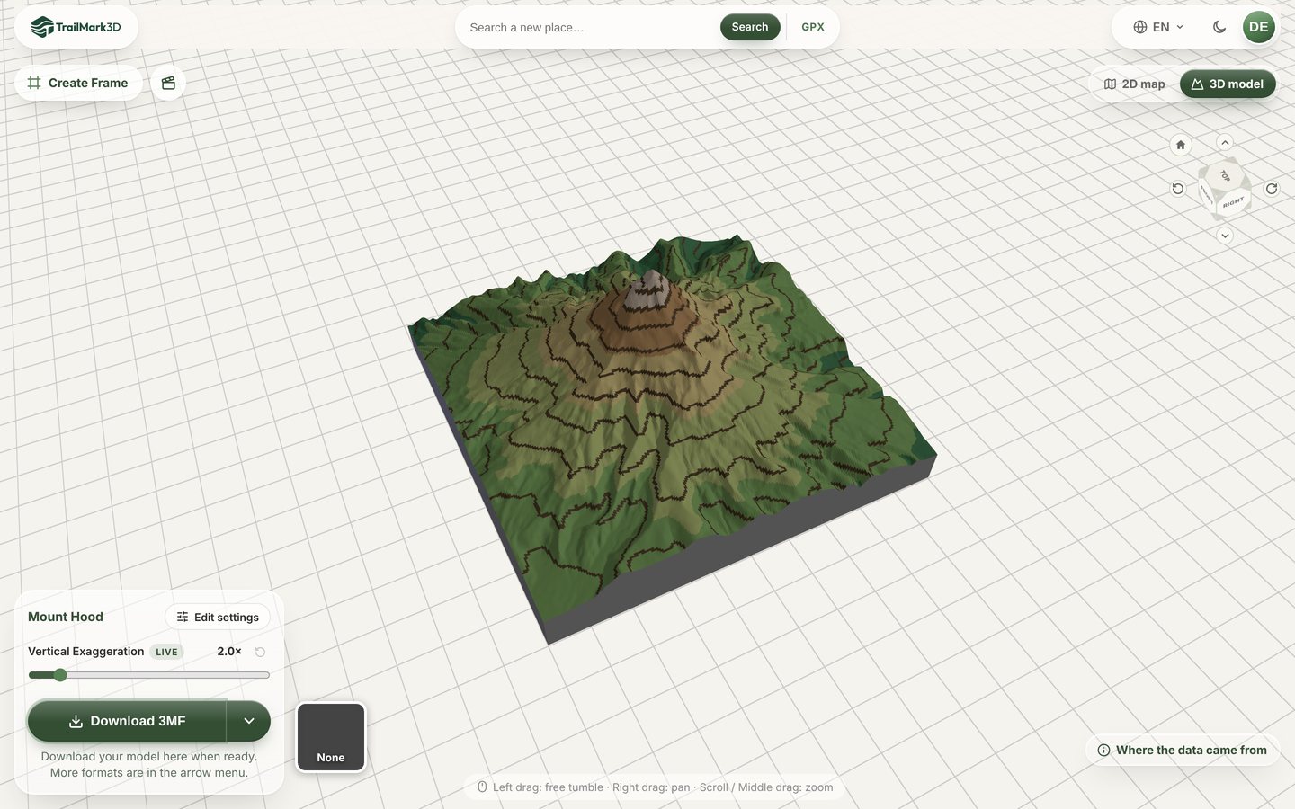
Topographic contour maps
Contour lines over elevation color bands, at the interval you choose.
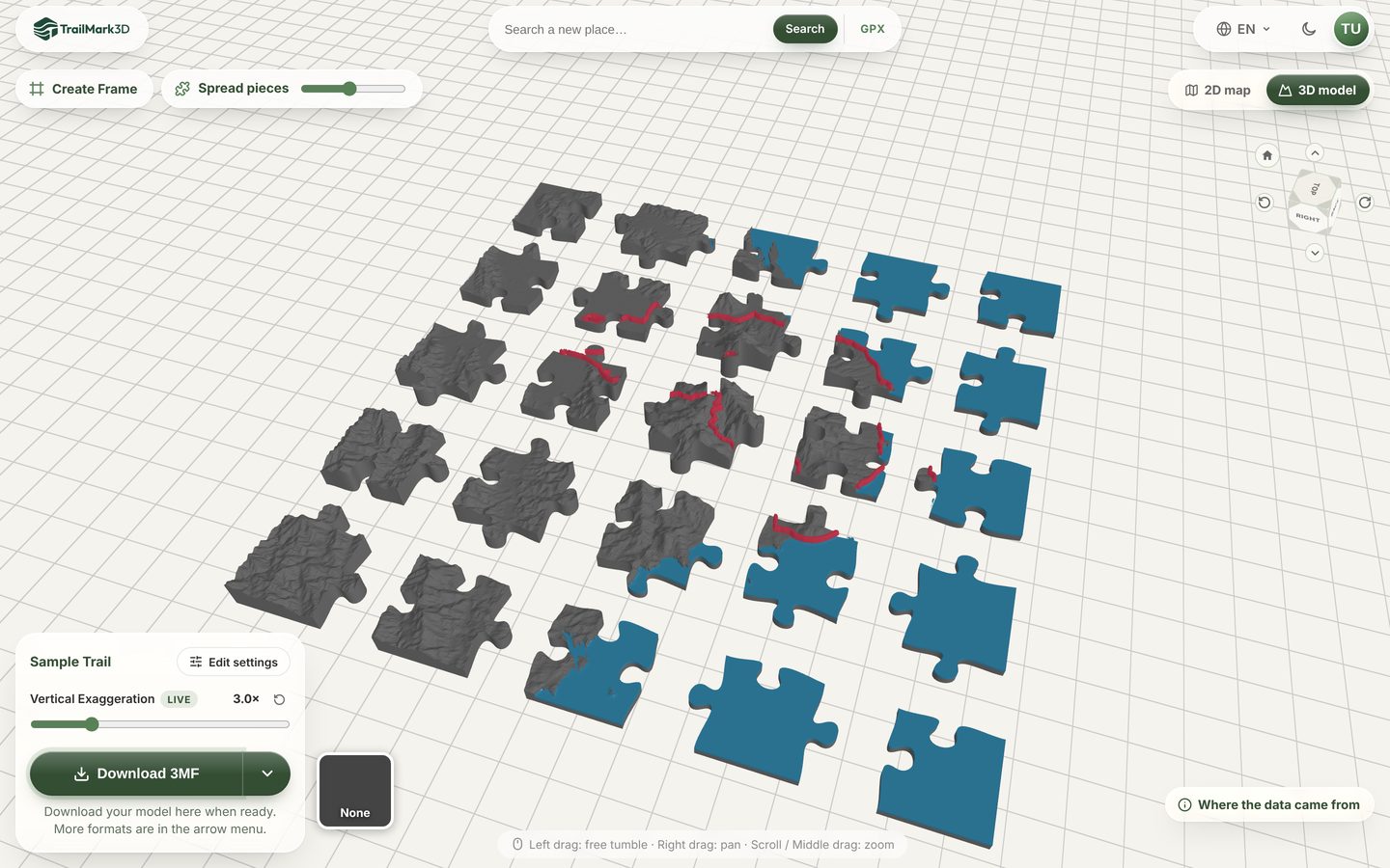
3D map puzzles
Cut any terrain into interlocking jigsaw pieces that print on one plate.
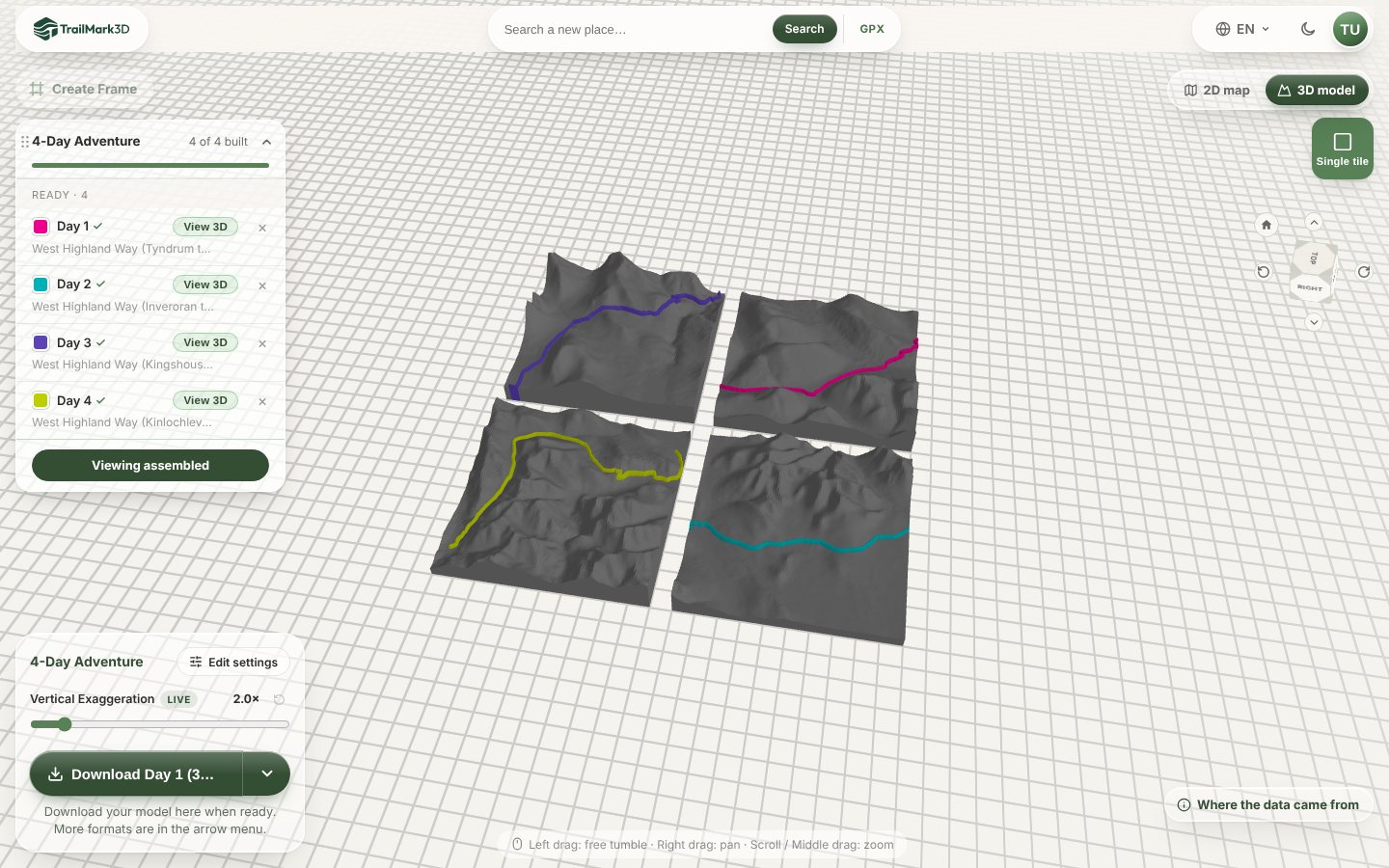
Multi-day hikes in 3D
One map tile per day, each trail in its own color, or the whole trek on one map.
Printed around the world, by people like you.
- 22,700+ models built
- 3,600+ makers
- 2,000+ places
GPX to STL, answered.
How do I convert a GPX file to STL?
Drop the GPX on this page or click Upload GPX. Frame the area, pick a shape and print size, and click Generate 3D Model. In about a minute you can download the terrain and your route as STL files for any slicer, or as one multi-color 3MF.
Can I 3D print my Strava, Garmin or Komoot route?
Yes. Export the activity or route as a GPX file from Strava, Garmin Connect, Komoot or your watch app, then upload it here. TrailMark3D does not need access to your account.
Can I make a 3D map without a GPX file?
Yes. Search any mountain, national park, city or coordinates and TrailMark3D builds a 3D terrain map of the area, with water, landcover and buildings if you want them.
Should I download STL or 3MF?
Download 3MF for a multi-color printer: terrain, trail, water and landcover stay separate parts with their colors. Download STL for any other slicer or printer: you get one file per part, plus a combined file to print in one color.
Is TrailMark3D free?
Yes, free to start with nothing to install. The Free plan makes 5 models a day and downloads STL and 3MF with a free account. Pro adds unlimited models, higher terrain detail, city buildings and multi-day trips.
What 3D printer do I need?
Any FDM printer that reads STL or 3MF. A multi-color printer such as a Bambu Lab AMS or Prusa XL prints the colors in one go; on a single-color printer you can swap filament at a layer or print the trail as a separate piece.
How does TrailMark3D compare with other GPX to STL tools?
GPXtruder and GPXTrack.xyz model only the route line. TouchTerrain makes terrain without your route, and TrailPrint3D needs Blender. TrailMark3D runs in the browser, builds the real terrain with your route, water and roads on it, and downloads a multi-color 3MF or STL files. Our comparison covers 10 tools, with what each one is best for.
Where did you go?
Search the place or drop the GPX. Free to start, no install.